Maps, Paintings, Etchings, Prints, Chromolithograph, Embroidery
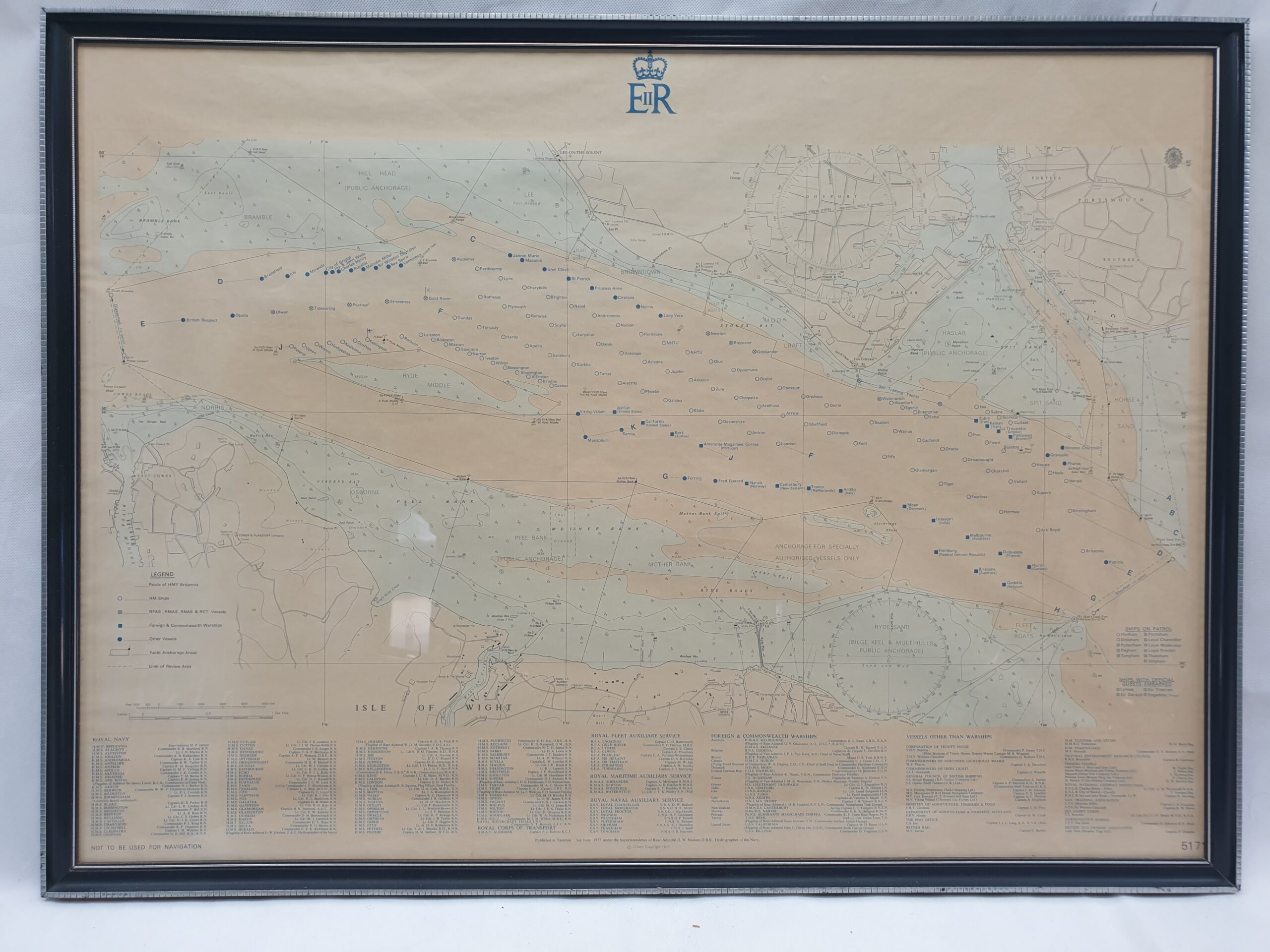
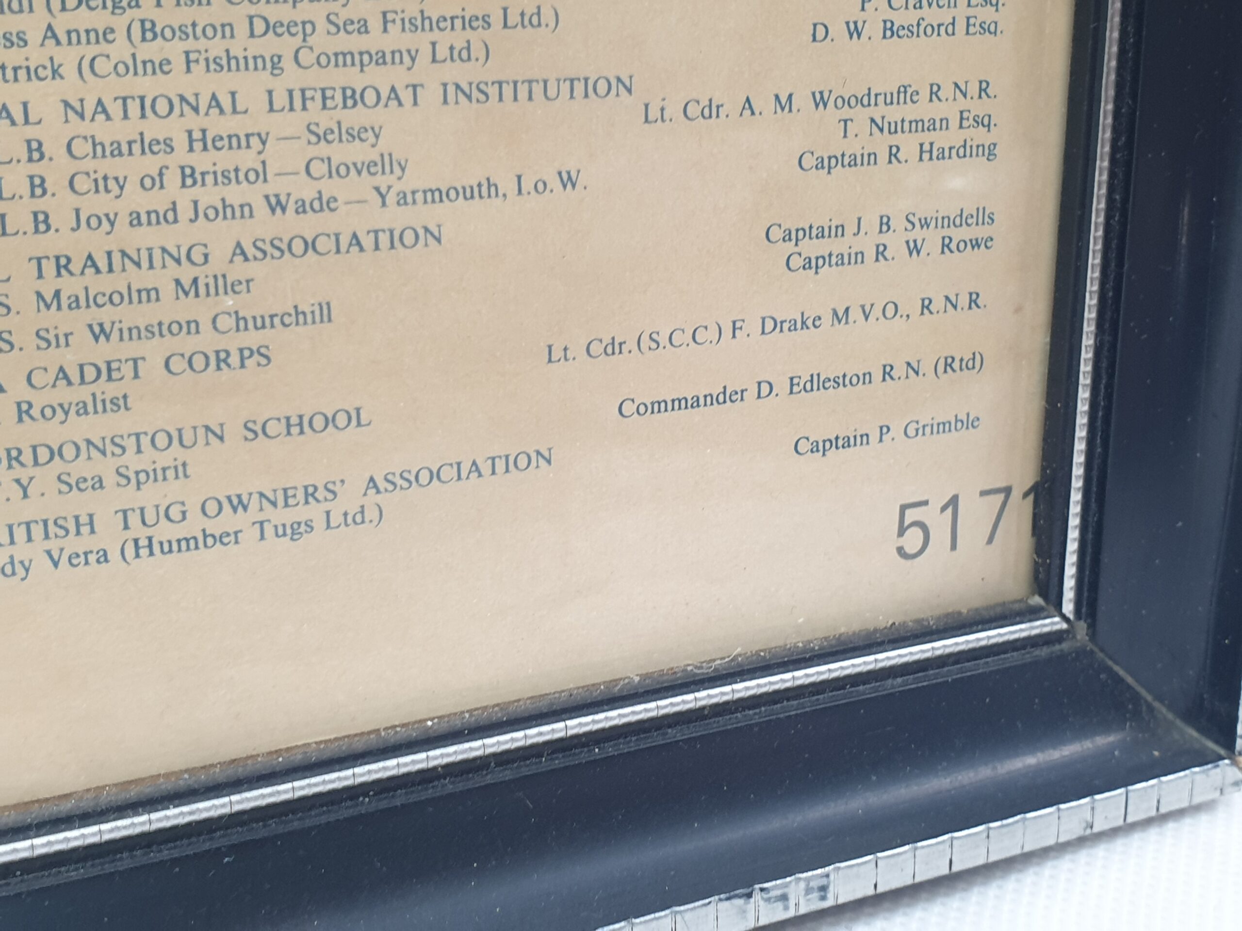
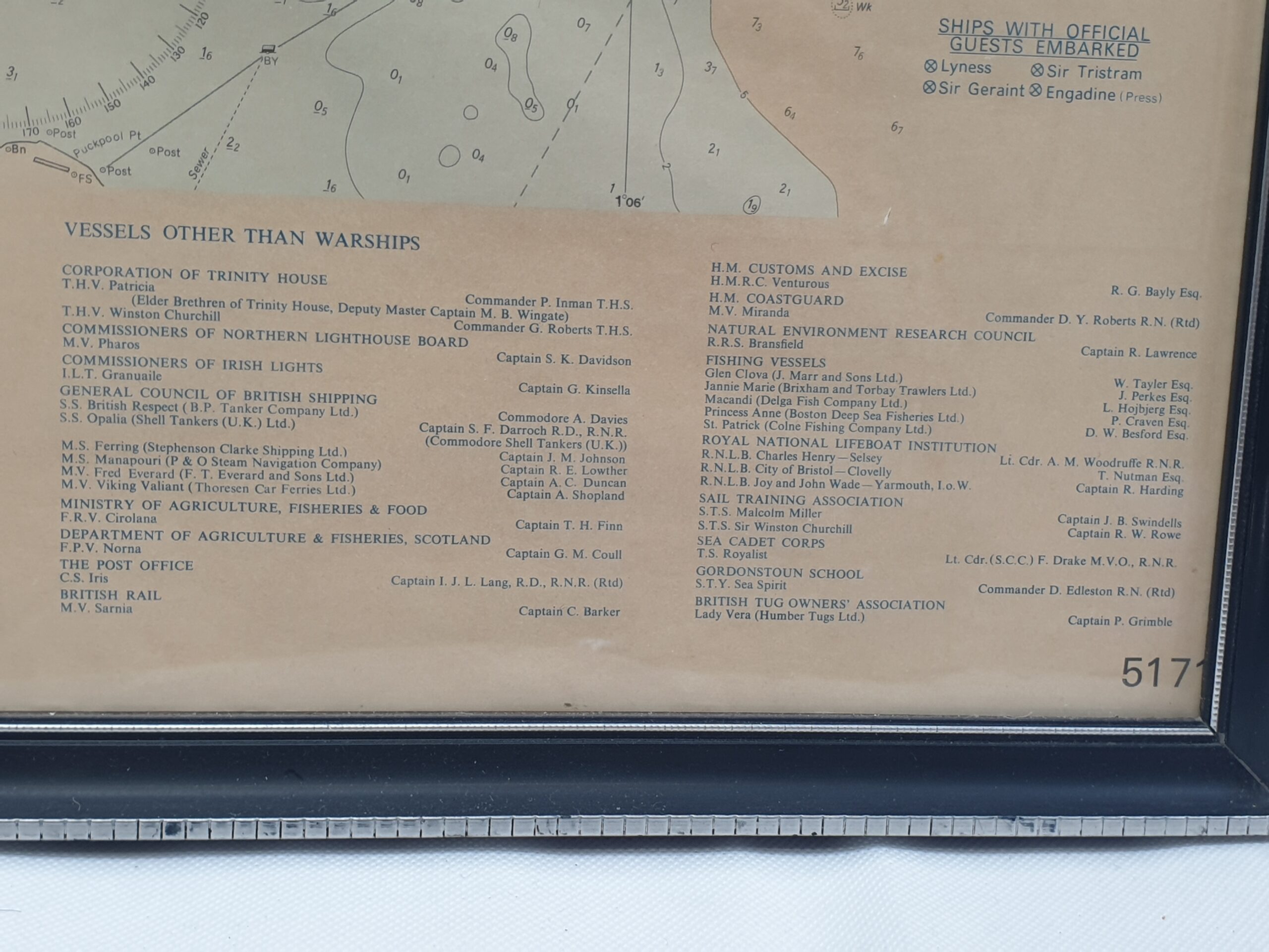
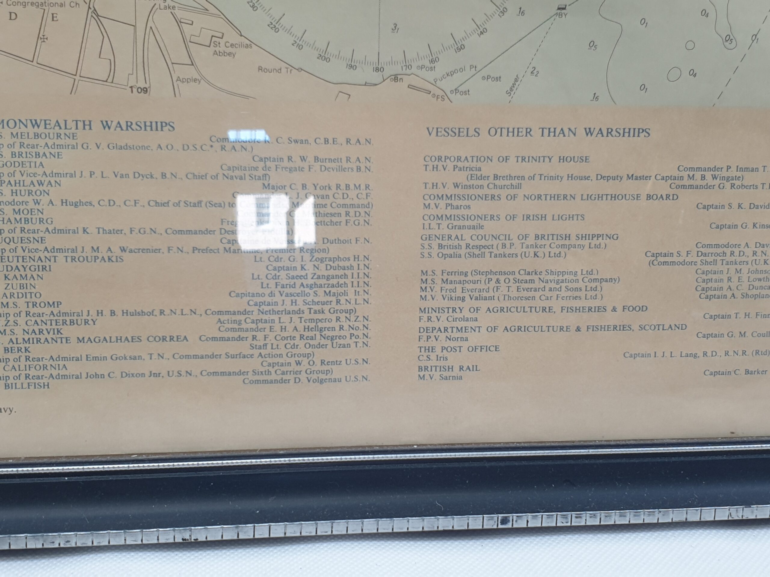
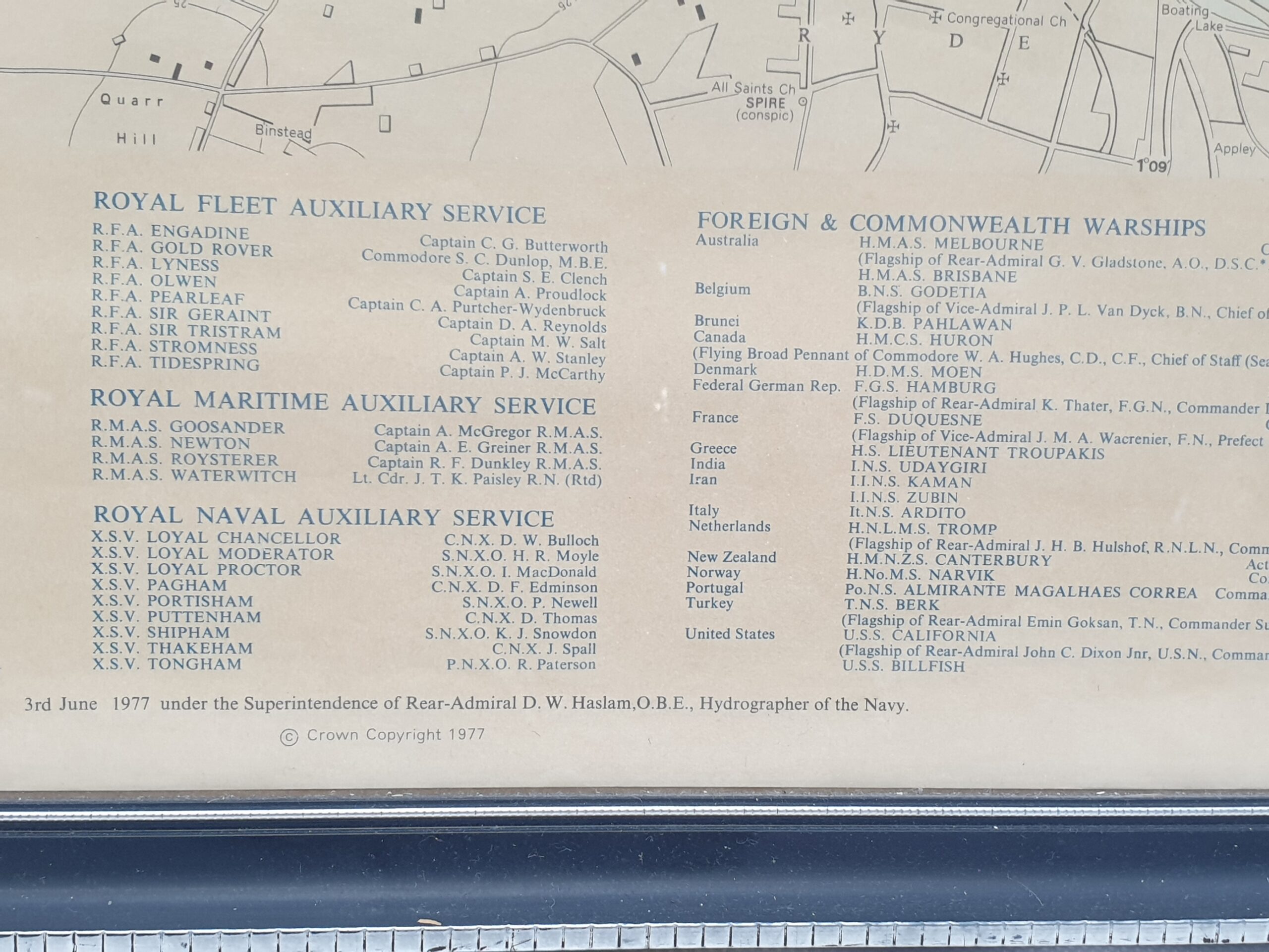
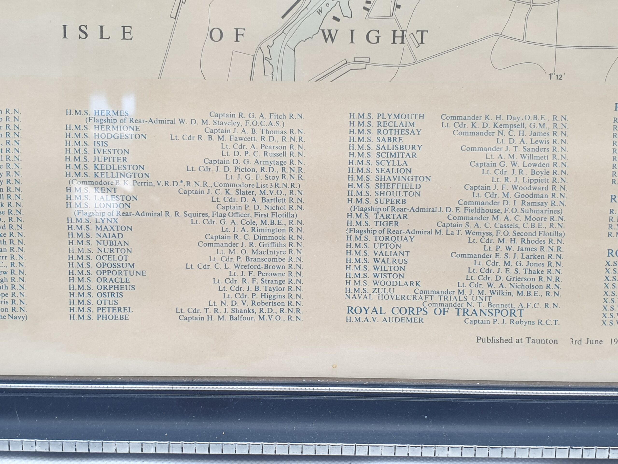
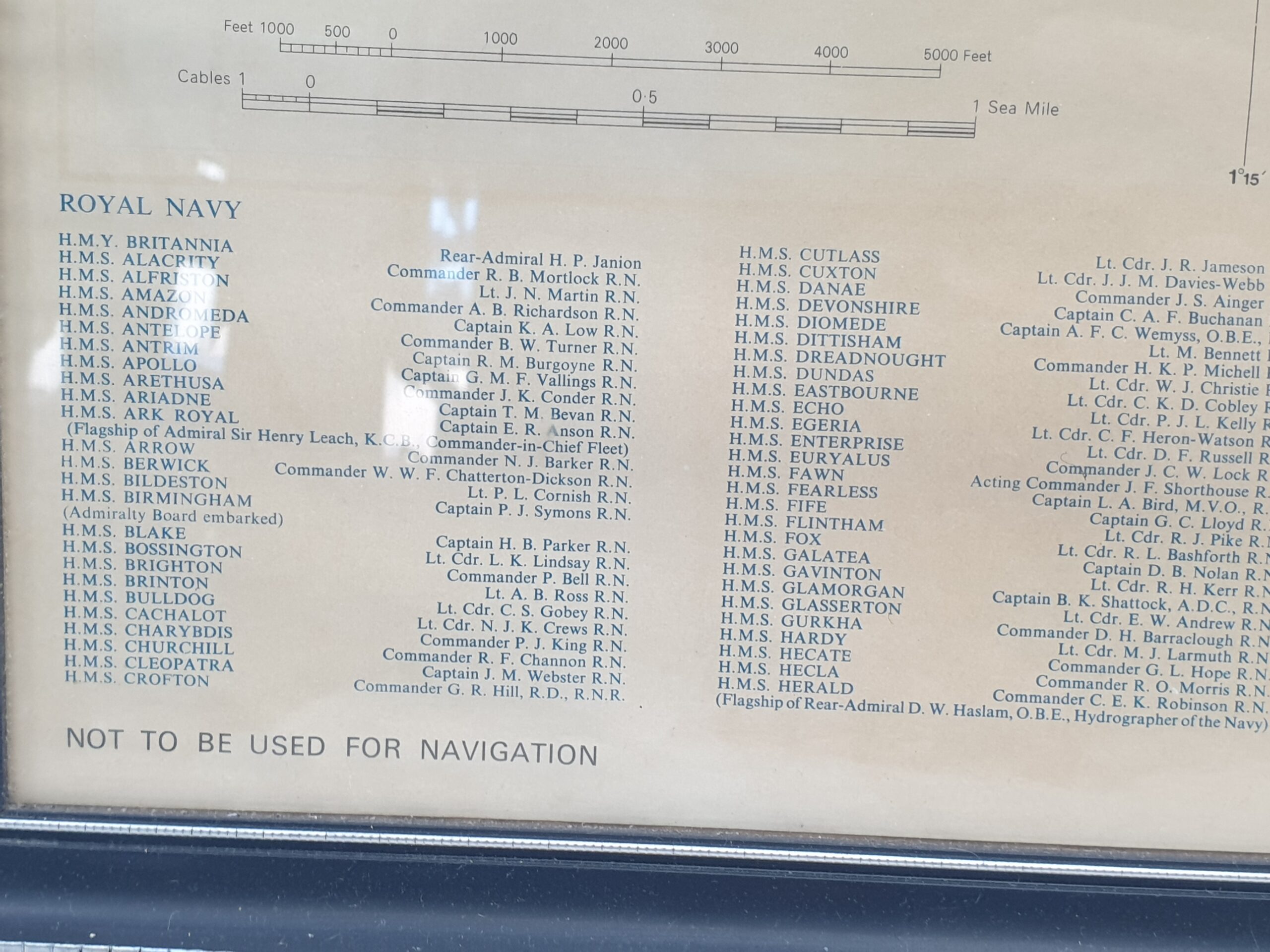
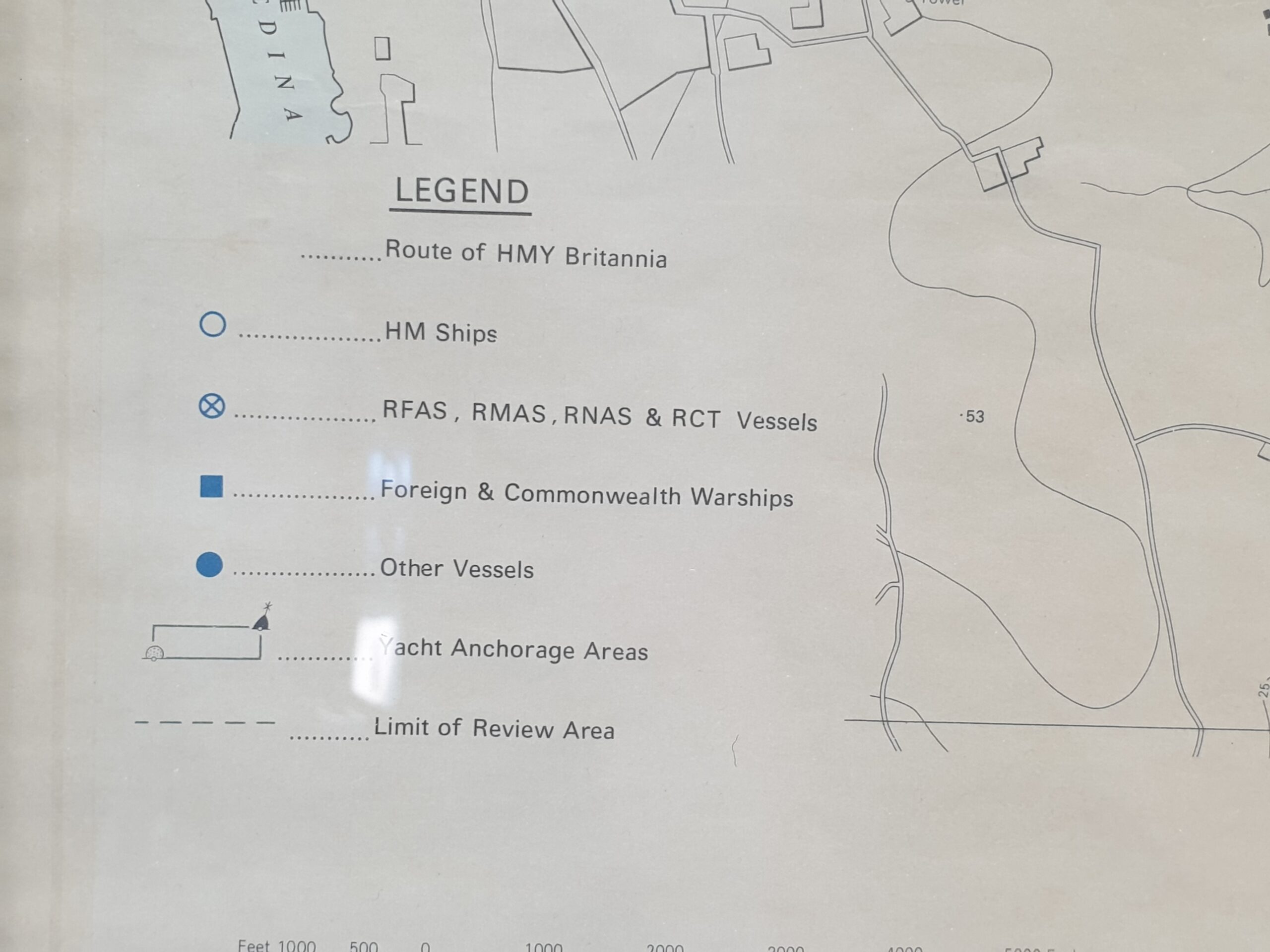
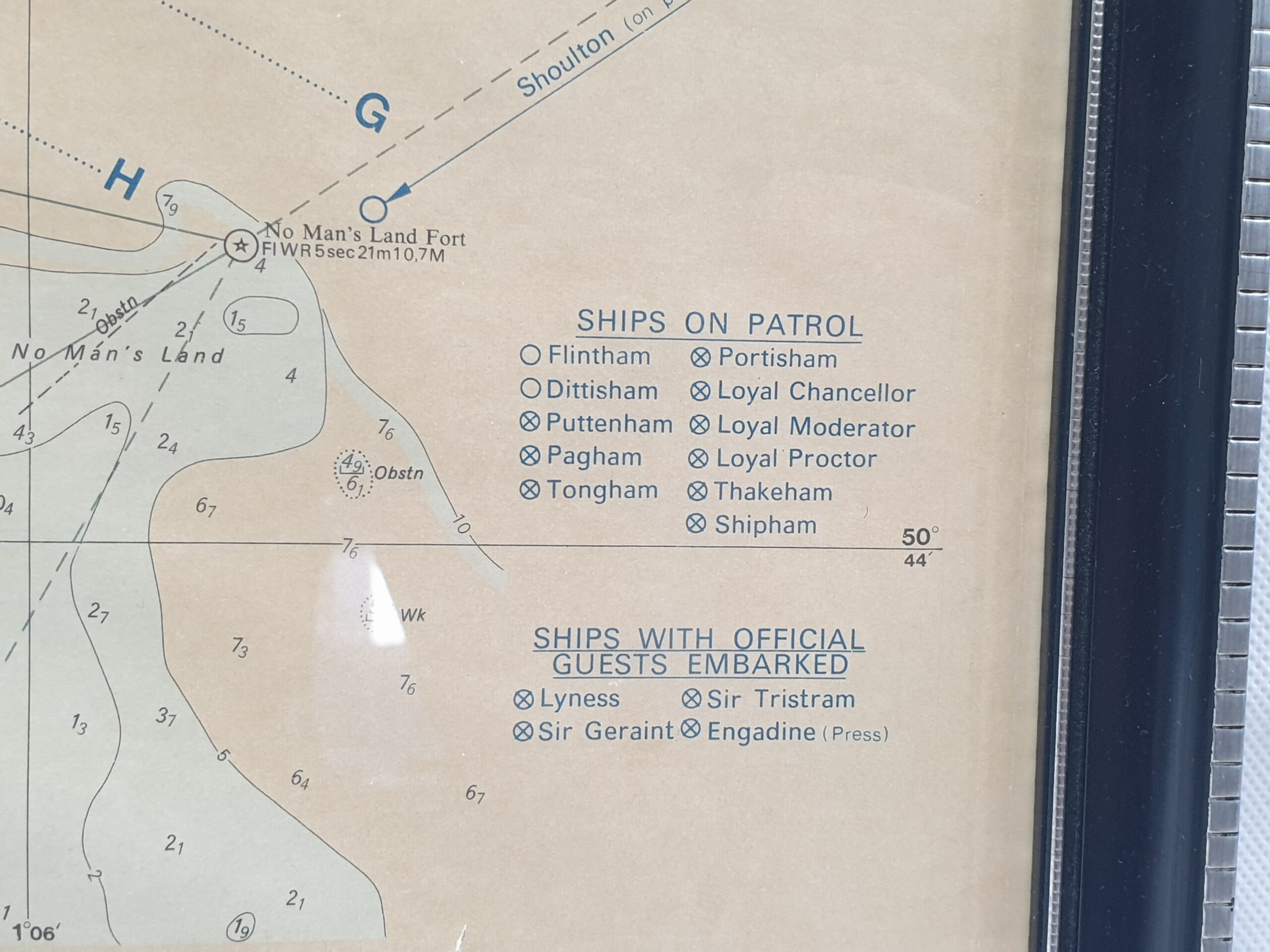
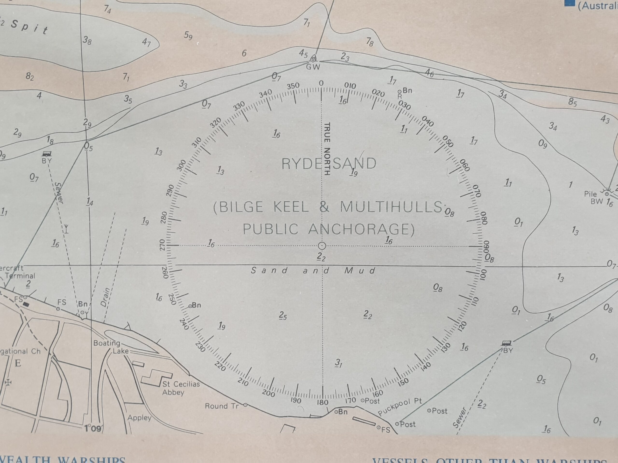
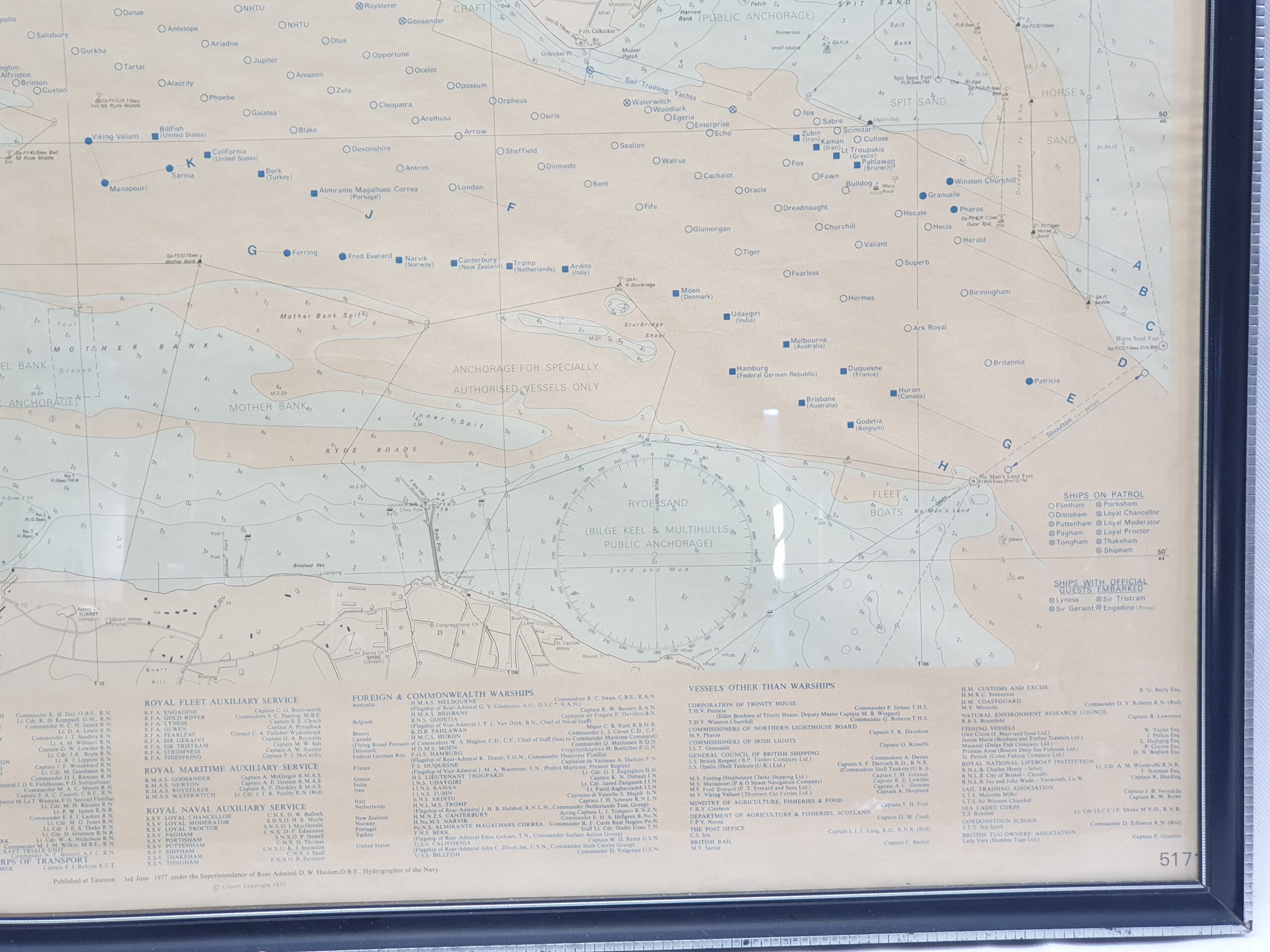
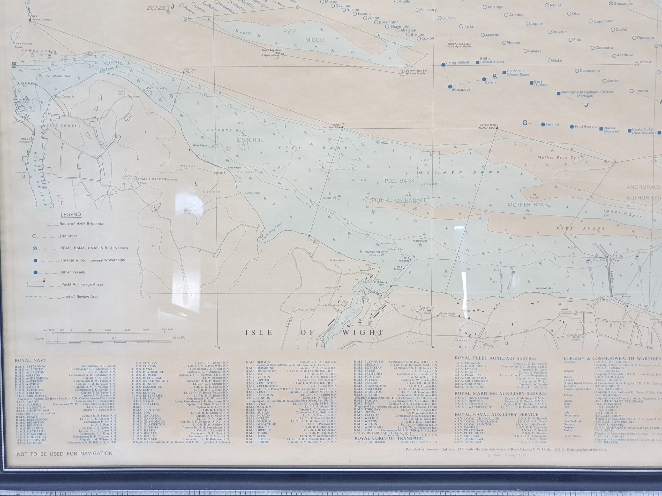
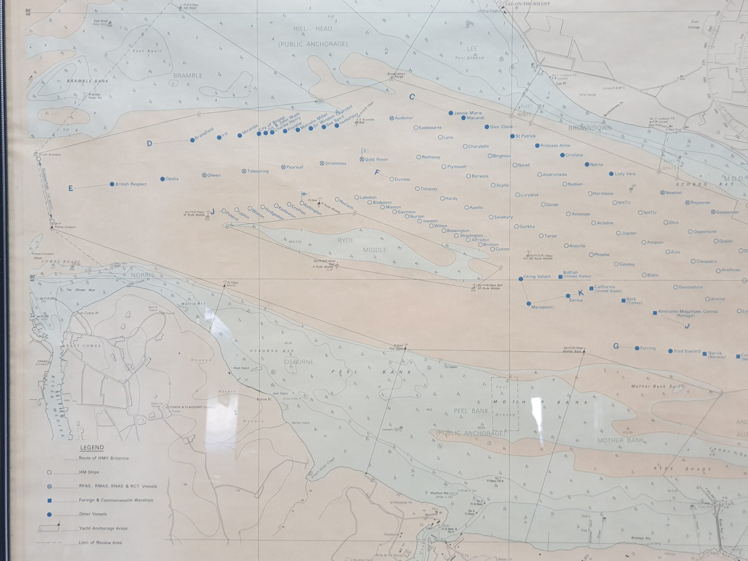
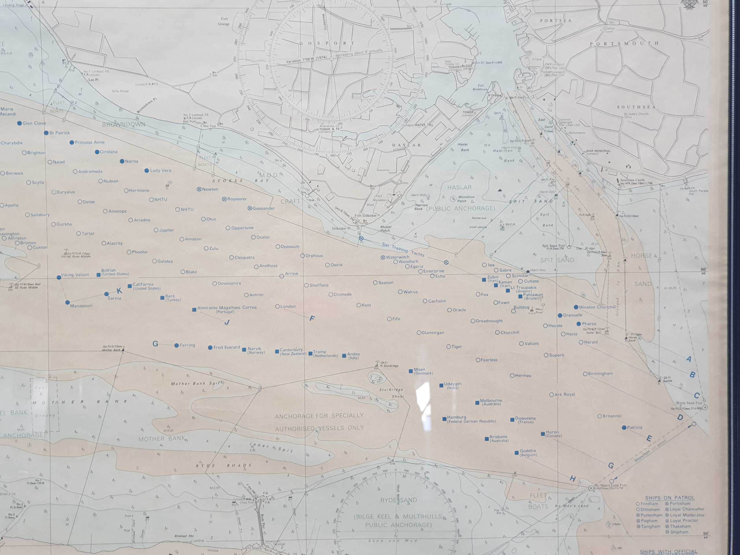
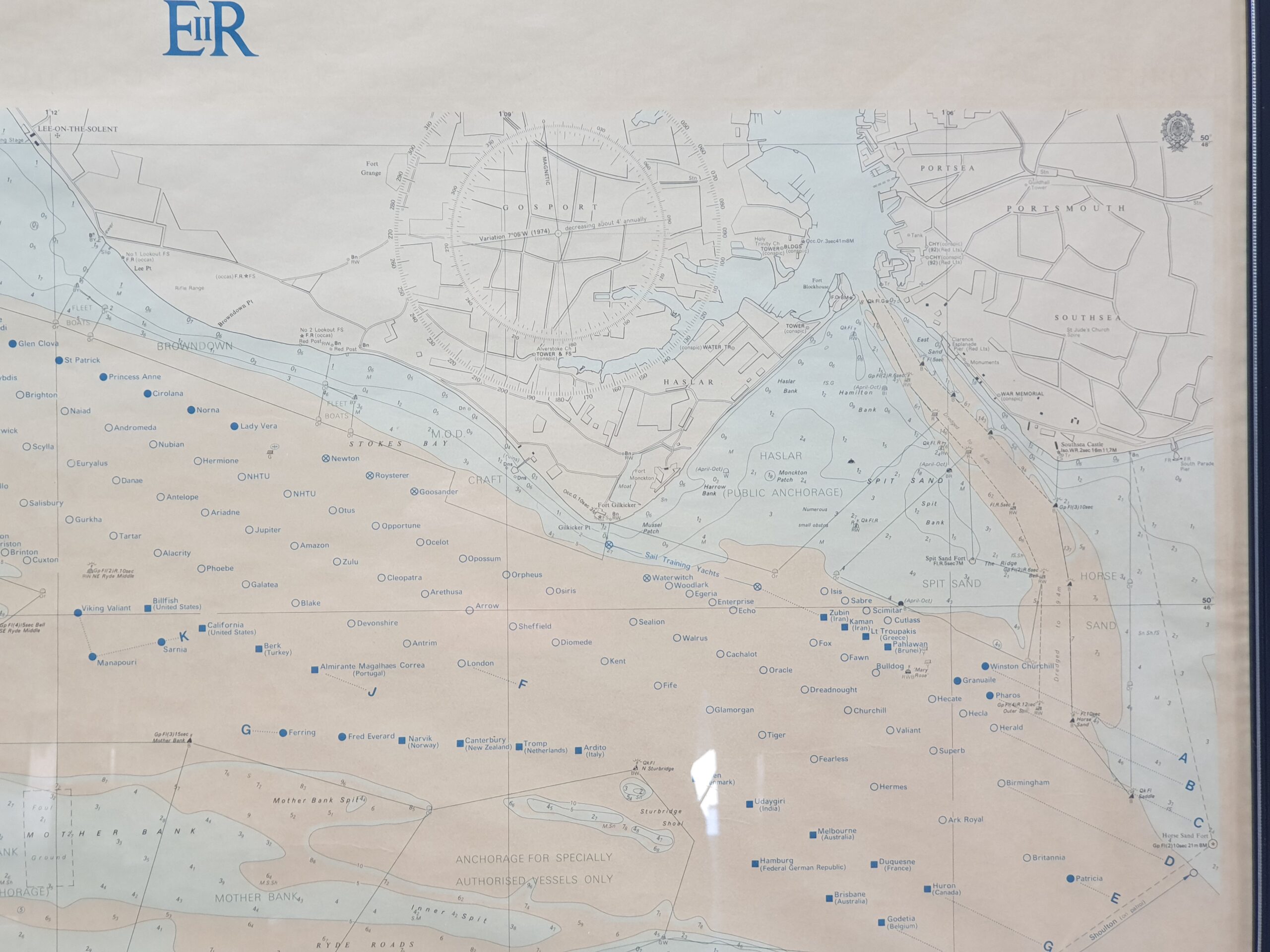
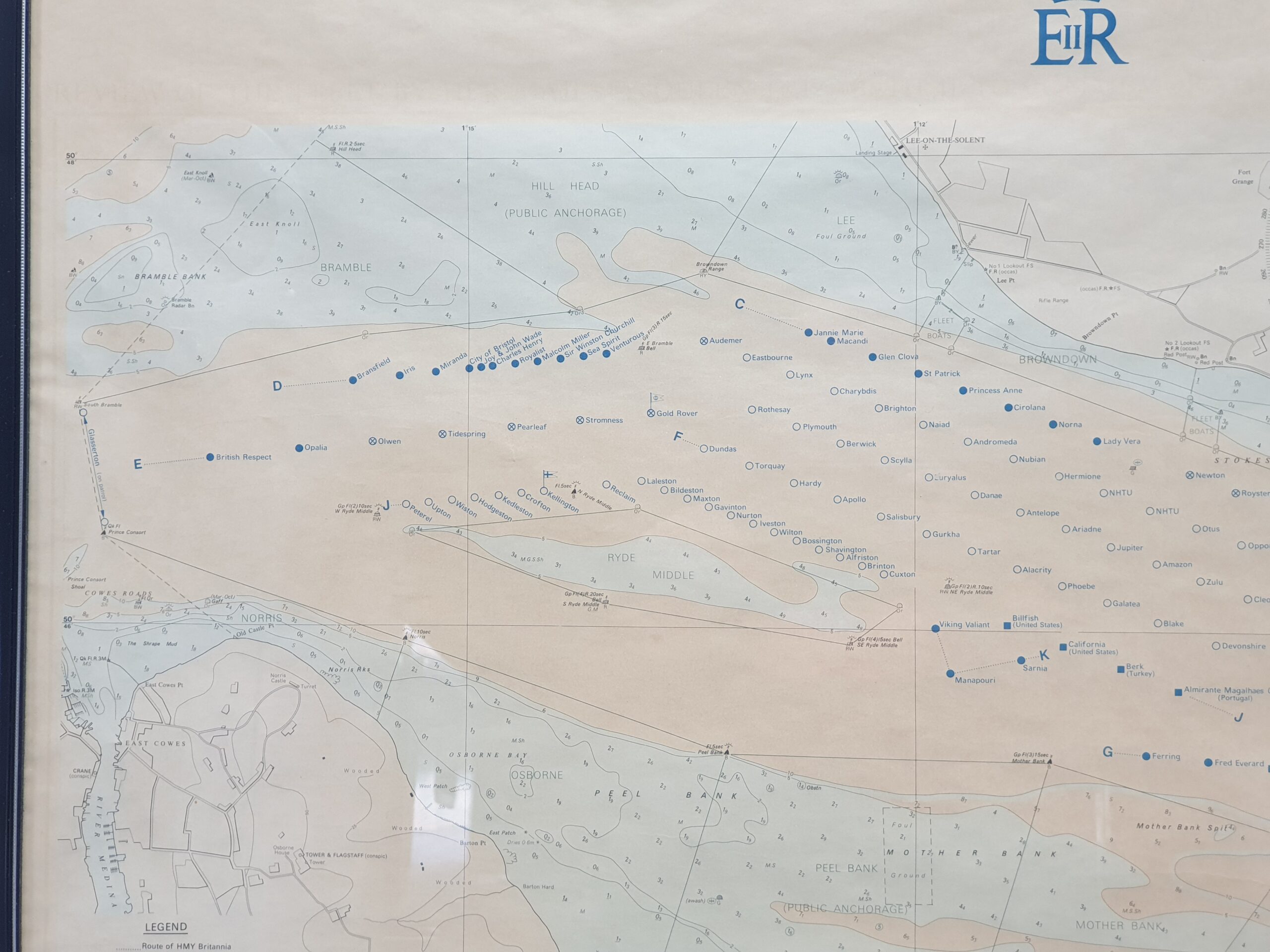
1977 Plan Of The Queens Silver Jubilee Spithead Fleet Map
Out of stock
Related products
- Add to cart
-
Paintings, Etchings, Prints, Chromolithograph, EmbroideryAdd to cart
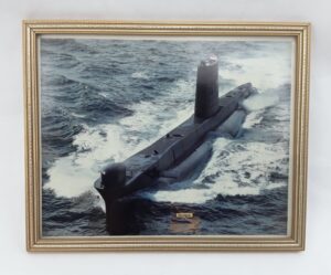
Photographic Print Of Royal Navy Submarine HMS Olympus
£25.00 - Add to cart
Reviews
There are no reviews yet.