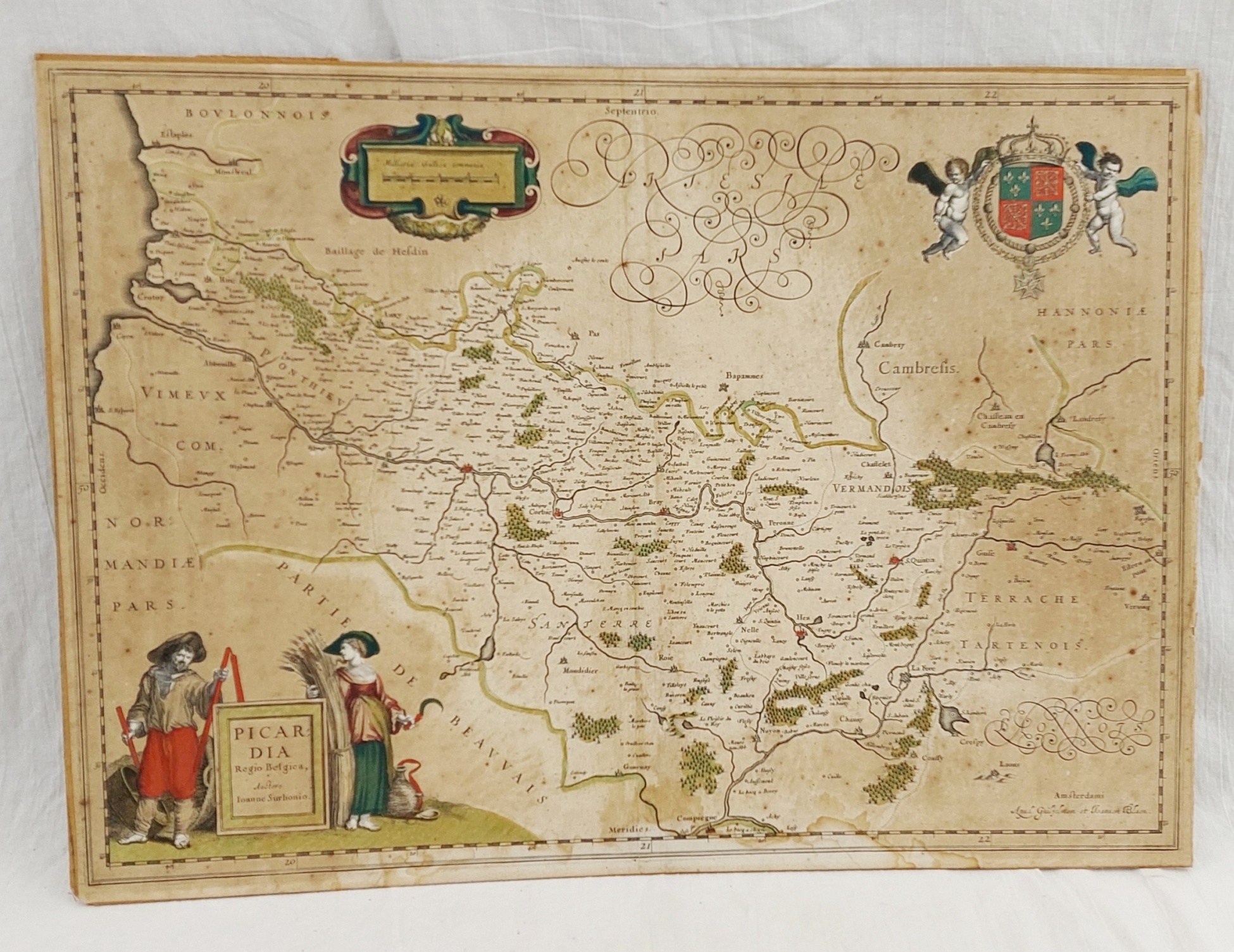
~ 1644 Blaeu Hand Coloured Map Of Picardy ~
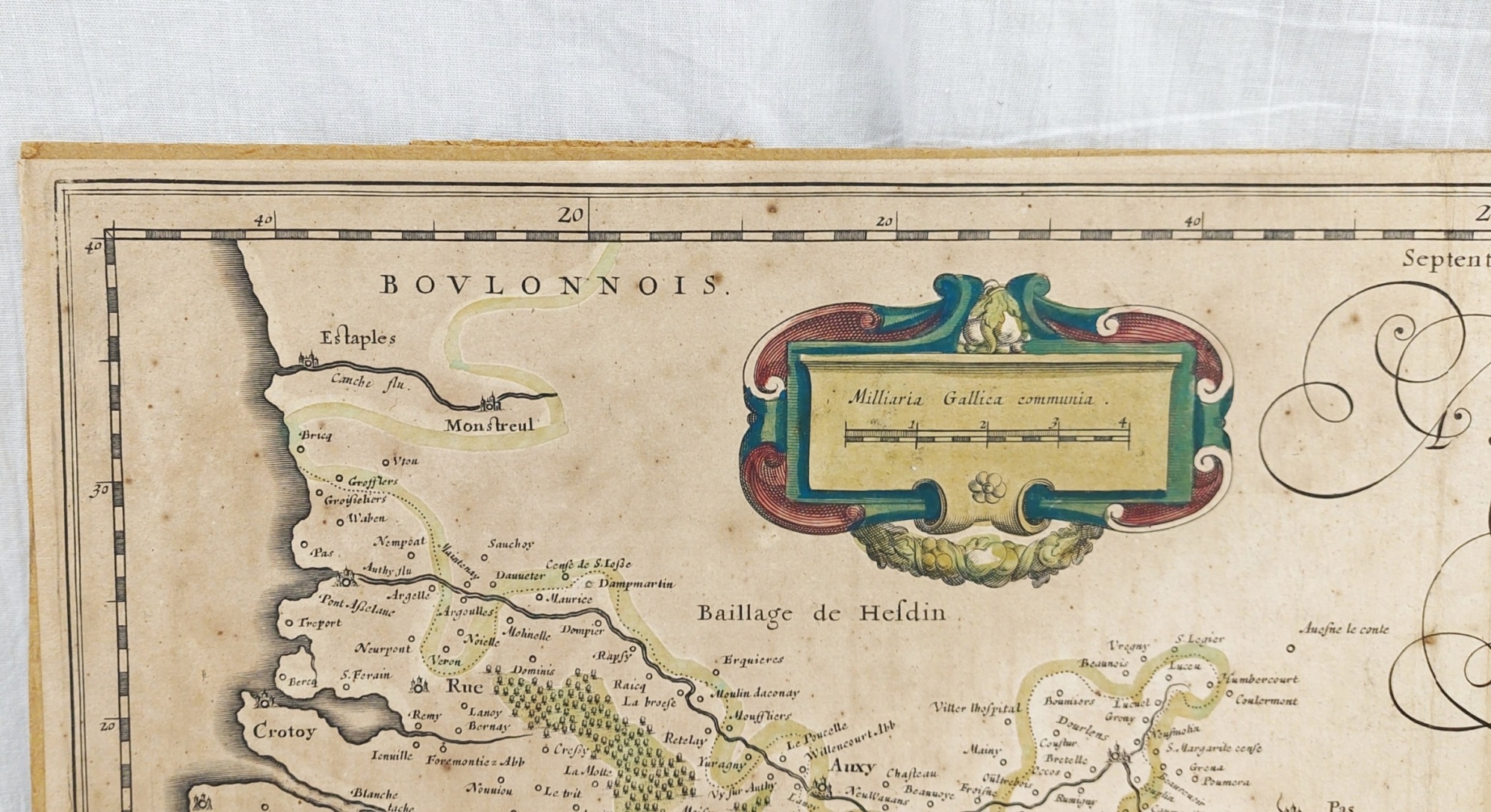
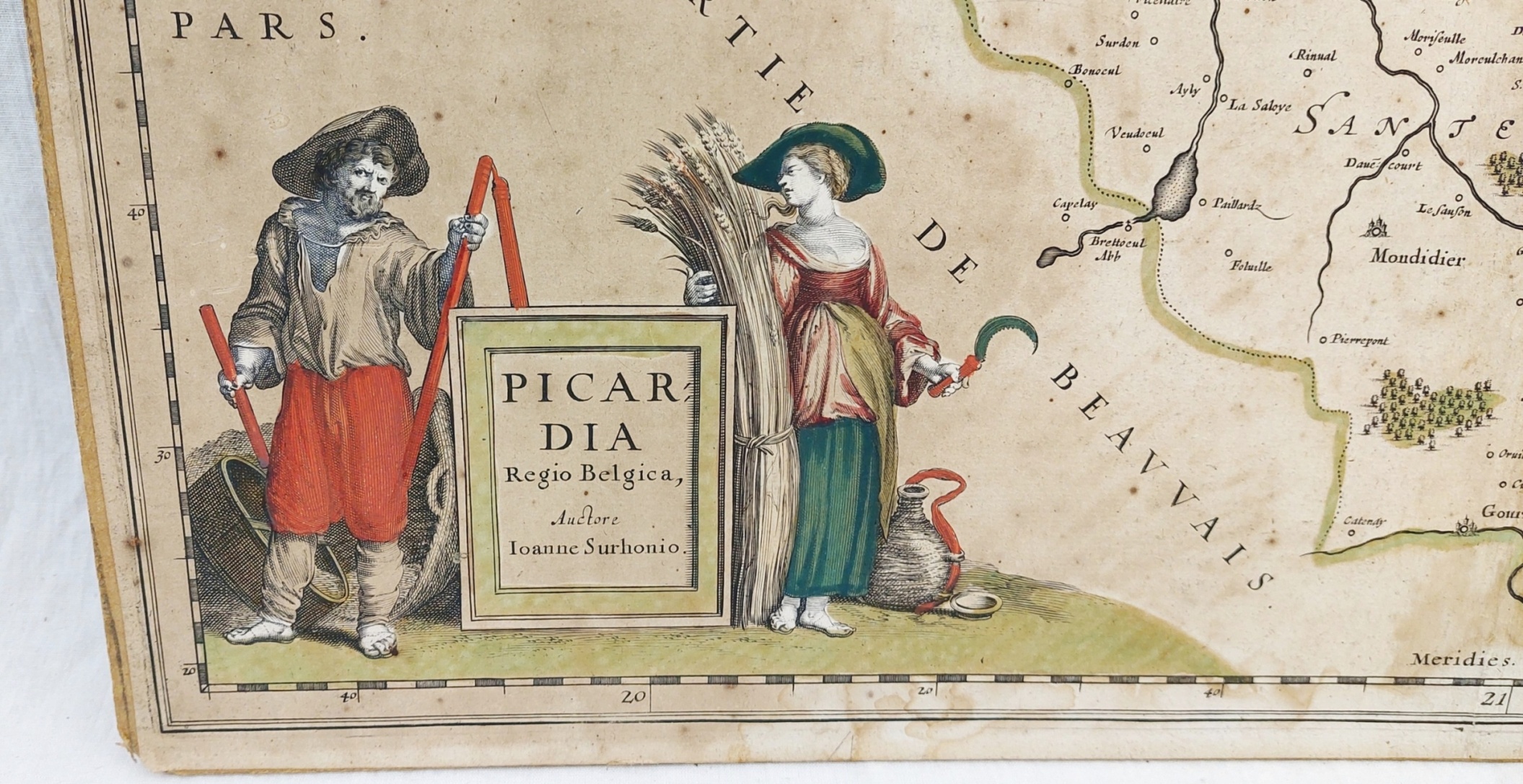
This is Willem Blaeu's map of Picardy, Northern France. The map focuses on the Somme River valley. Amiens, chief city of the region, St. Quentin and La Fere are given particular emphasis.
Blaeu's map is a faithful copy of Jean de Surhon's 1557 map, as presented in Abraham Ortelius' 1579 Theatrum Orbis Terrarum.
This example appeared in one of the Latin editions of Atlas Novus, between 1644 and 1655.
~ Condition ~
Please refer to the images for the condition. There is general foxing and staining.
~ Dimensions ~
The map is 55cm (21.5 inches) wide and 39cm (15.5 inches) tall.