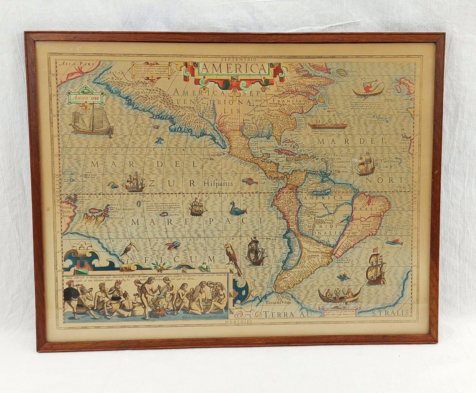
~ Framed Circa 1606 Septentrio America Hand Coloured Map By Jodocus Hondius Of Amsterdam ~
This beautiful and handsomely illustrated map of North and South America first appeared in a general world atlas published by Jodocus Hondius in 1606 of Amsterdam.
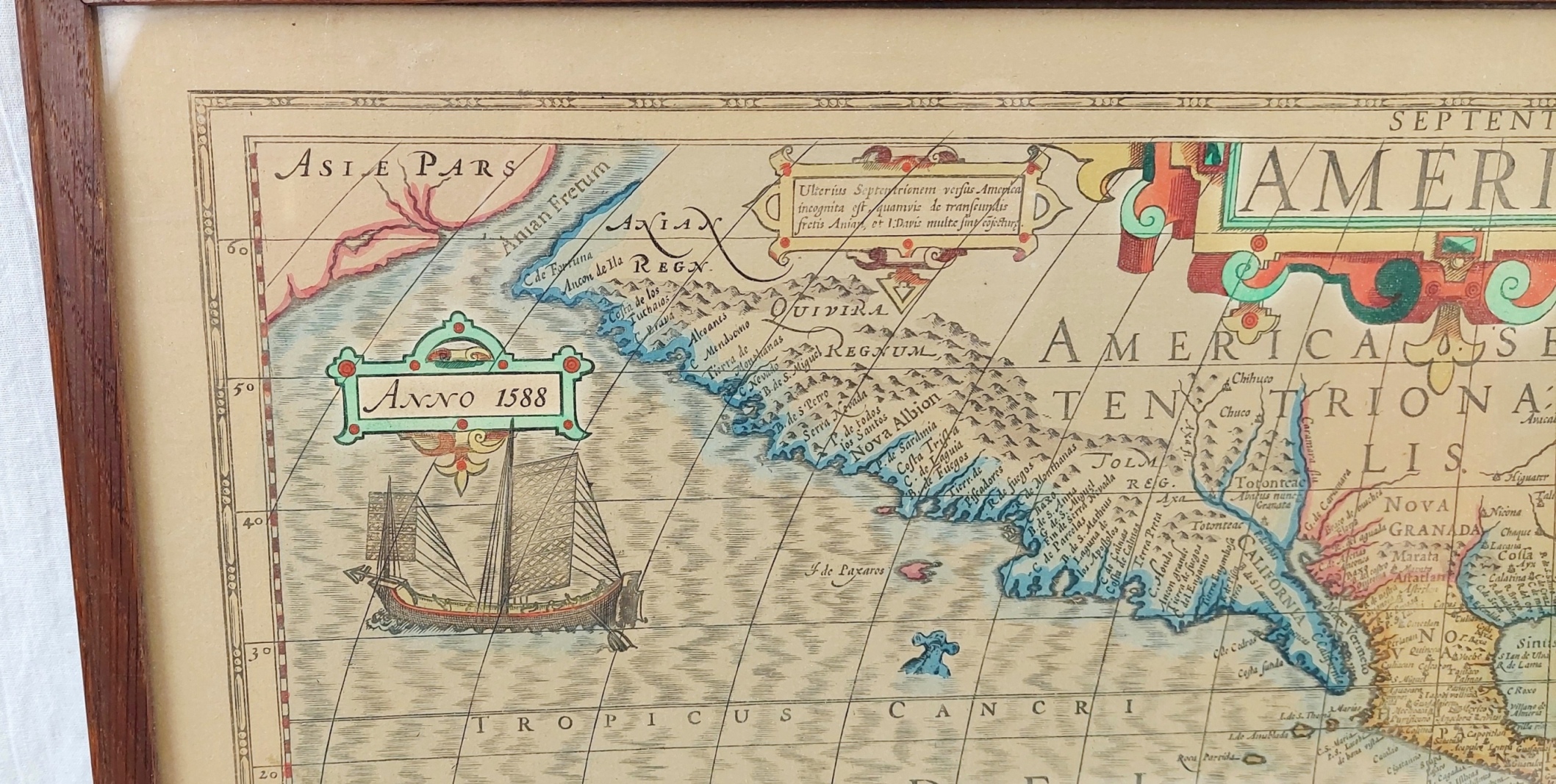
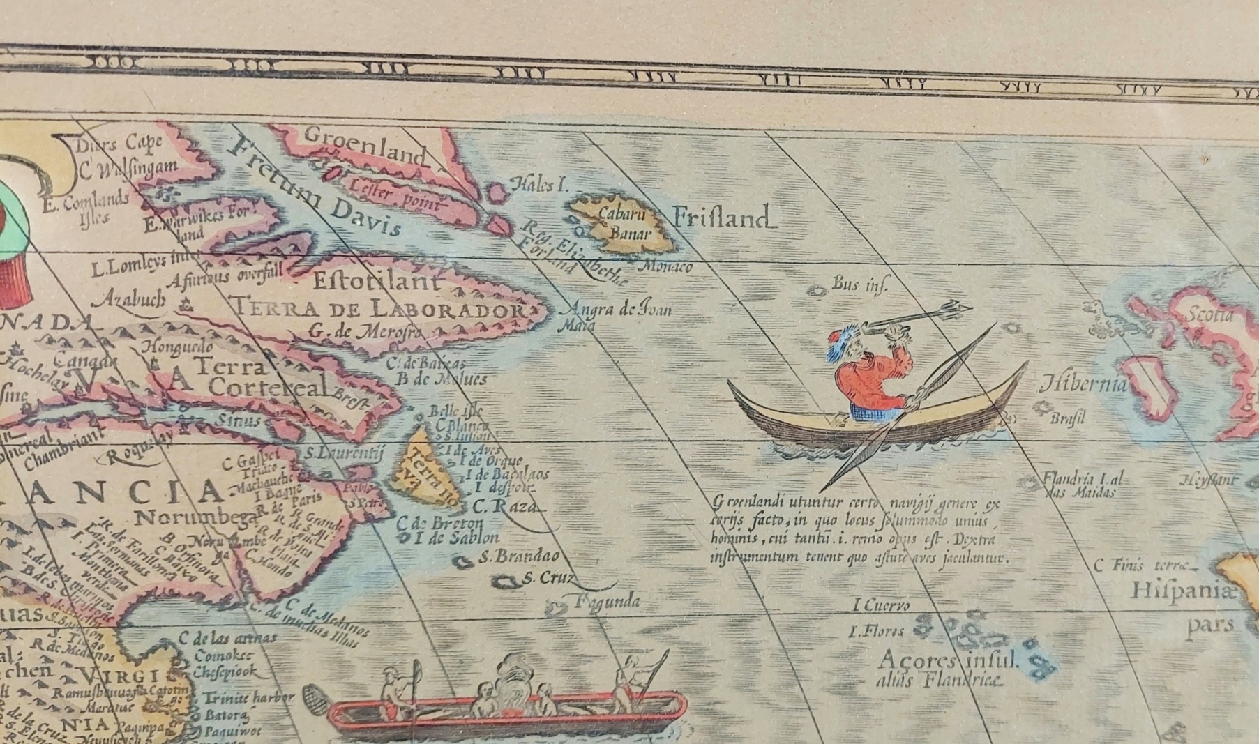
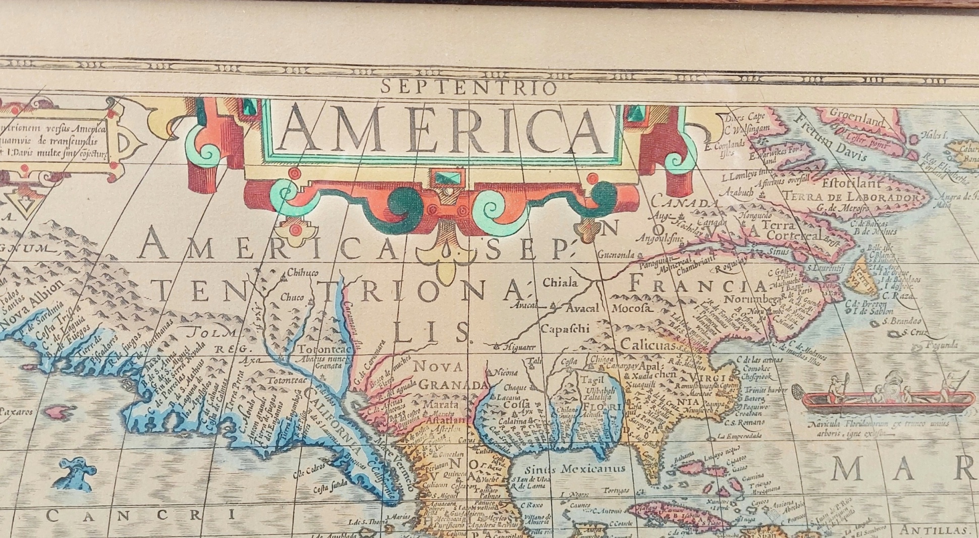
It was reprinted many times until 1630. It is a stereographic projection with the curvature of the earth displayed by curving longitudinal lines that join each Pole. Central and South America are portrayed quite accurately but the extreme western extension of North America is exaggerated.
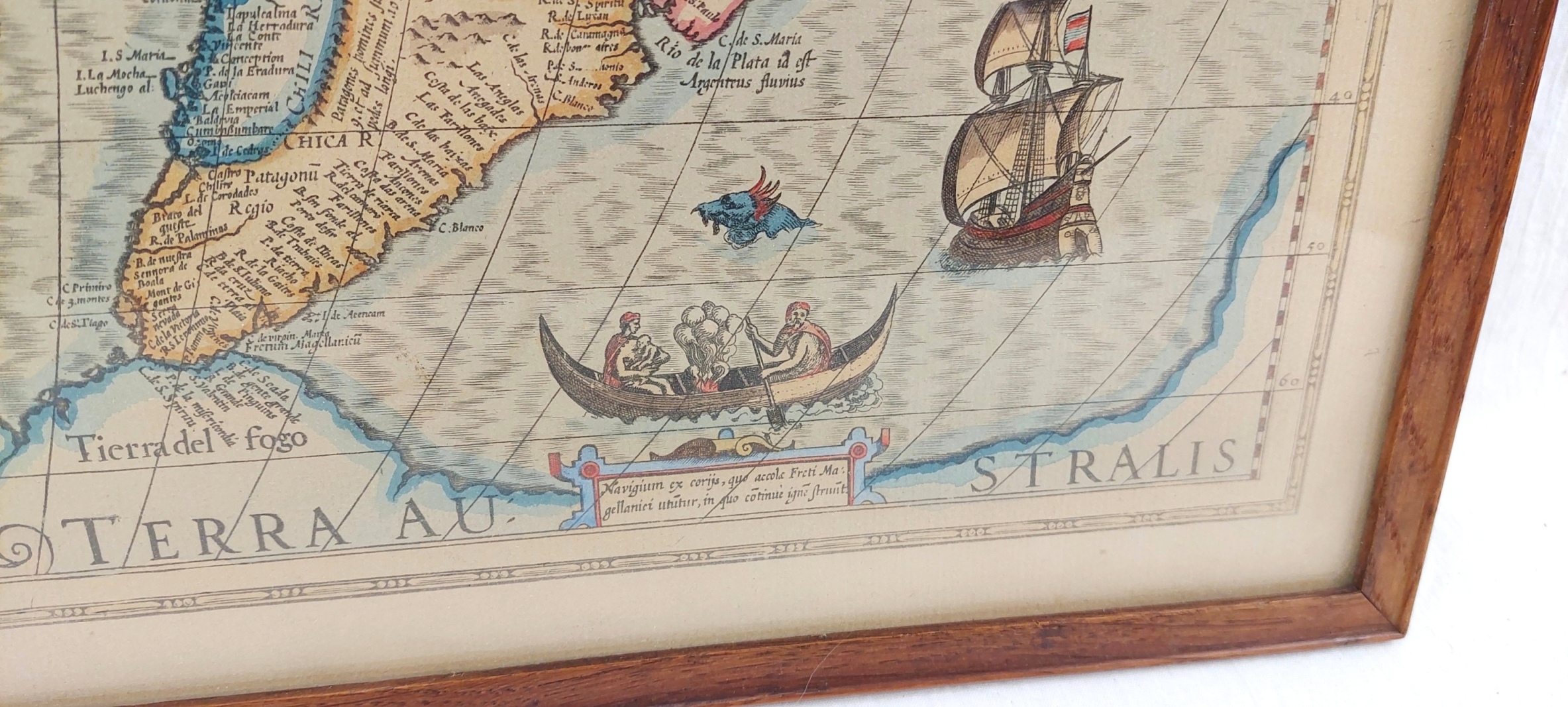
Hondius was one of the first cartographers to include the discoveries made by Sir Francis Drake's raiding expedition against the Spanish empire and Drake's resulting circumnavigation of the globe between 1577 and 1580. On this map present-day California is labeled Nova Albion, which is the name given it by Drake.
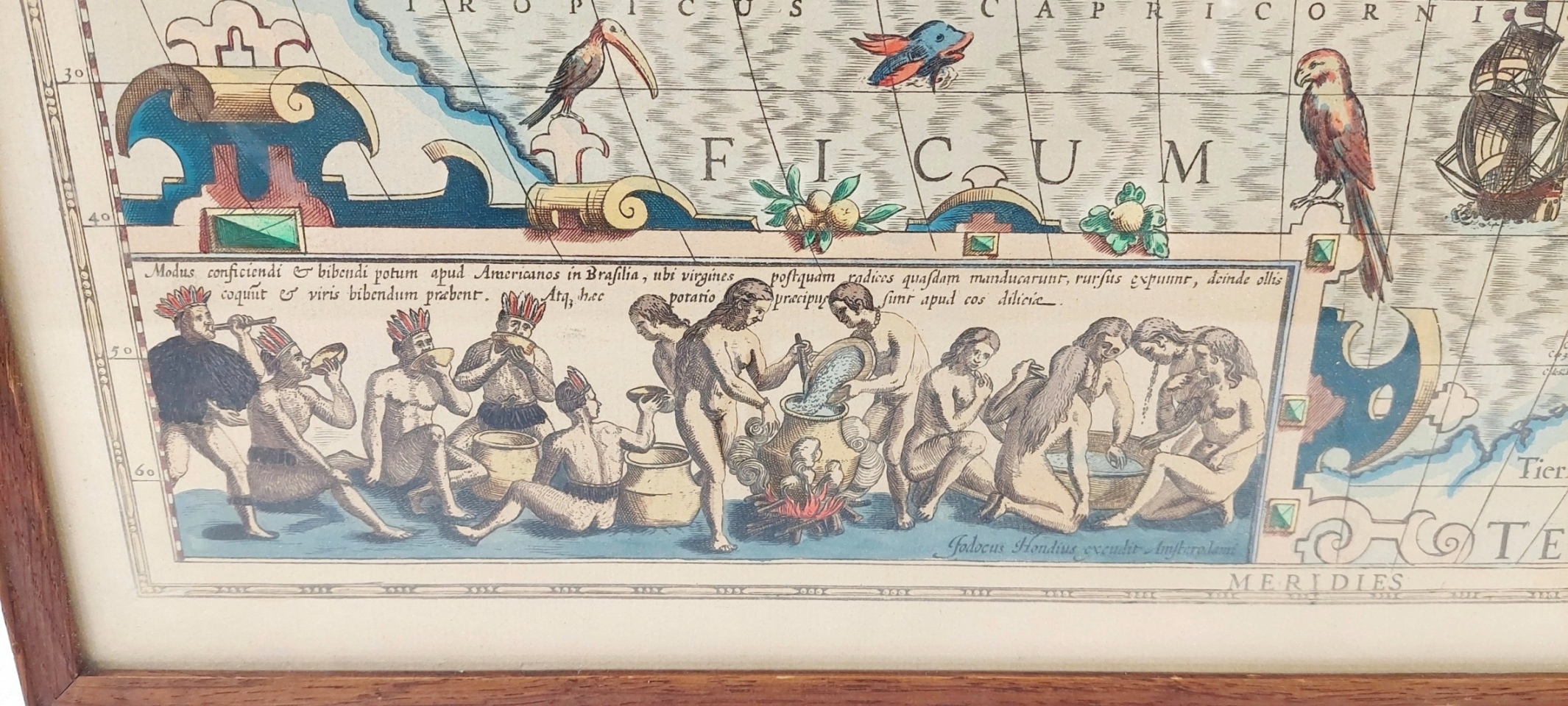
Inset in the lower left is an illustration of Brazilian natives making a local drink derived from Hans Staden's voyage as recorded by de Bry.
The large ship in the Pacific opposite Nova Albian is a Japanese sailing vessel with a large anchor on the bow.
It is presented in a wooden glazed frame.
~ Condition ~
Please refer to the images.
~ Dimensions ~
The map is 56cm (22 inches) wide and 43cm (17 inches) tall.